State Route 80

|
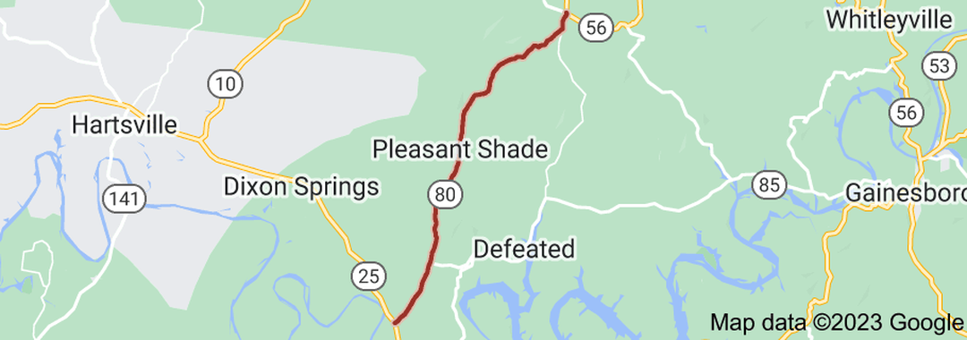
State Route 80 (SR 80) is a north-south state highway in Middle Tennessee. The 14.08 miles (22.66 km)-long road traverses portions of Smith and Macon Counties.
SR 80 begins in Smith County just west Carthage at an intersection with SR 25 on the banks of the Cumberland River. It then goes north as a 2-lane country road, having an intersection with SR 85, about 2 miles west of Defeated, just after passing through Monoville. It the passes through some rolling hills and farmland before passing through Pleasant Shade. It then crosses into Macon County shortly afterwards. It then winds through some more hills before having an intersection with Defeated Creek Road, a back road to Defeated. SR 80 then ends at a 4-way stop intersection with SR 56 and SR 262 in Willette. |
|
Length of Route
14.08 mi. |
Begins:
SR 25 near Carthage |
Ends:
SR 56/SR 262 in Macon County |
Counties Covered:
Smith, Macon
Smith, Macon
State Route 80 Images: