
State Route 339
|
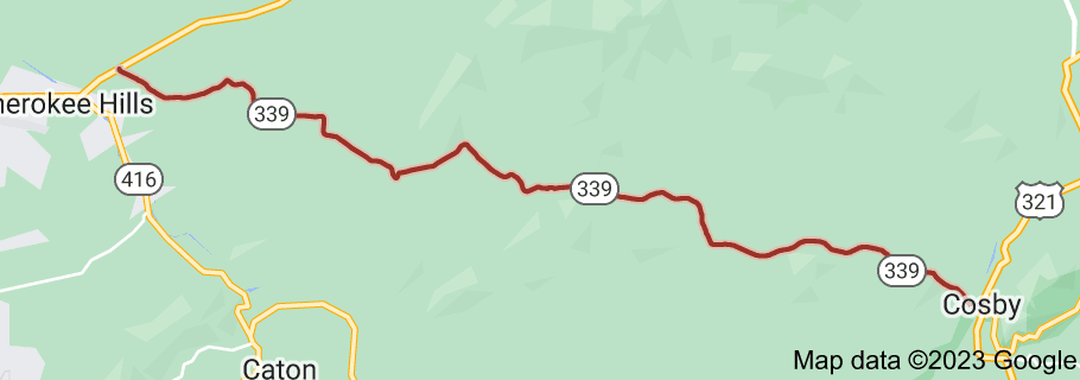
State Route 339 (SR 339) is a 23.1 miles (37.2 km) long east-west state highway in the mountains of East Tennessee, connecting Cherokee Hills with Cosby. For the majority of its length, SR 339 is known as Jones Cove Road, but other short sections are known as Long Springs Road and Old Newport Highway. SR 339 begins as Long Springs Road in Sevier County in Cherokee Hills at an intersection with US 411 (SR 35). It goes southeast through farmland to an intersection with Old Newport Highway, which it follows for approximately 1.3 miles. It then turns right onto Jones Cove Road and winds its way east through farmland and rural areas, paralleling the East Prong of the Little Pigeon River for most of the river's remaining length. The highway then passes through rugged mountainous terrain at the foot of English Mountain for several miles before crossing into Cocke County. SR 339 then enters Cosby and passes through farmland for a short distance before coming to an end at an intersection with US 321/SR 32 (SR 73). The entire route of SR 339 is a two-lane highway.
|

Length of Route
23.1 mi. |

Begins:
US 411/SR 35 in Cherokee Hills |
Ends:
US 321/SR 32/SR 73 in Cosby |
Counties Covered:
Sevier, Cocke
Sevier, Cocke
State Route 339 Images: