State Route 141
|
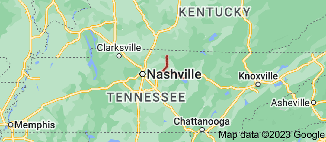
State Route 141 (SR 141) is an east–west highway in Middle Tennessee. The road begins southeast of Westmoreland and ends in Silver Point. The current length is 67.59 mi (108.8 km).
SR 141 is one of very few state routes in Tennessee that actually changes its cardinal directions, from north-south to east-west, which happens in Lebanon at the second intersection with US 70. |
|
Length of Route
67.59 mi. |
Begins:
SR 52 in Macon County |
Ends:
SR 56 in Silver Point |
Counties Covered:
Macon, Trousdale, Wilson, Smith, DeKalb, Putnam
Macon, Trousdale, Wilson, Smith, DeKalb, Putnam
State Route 141 Images: